
The Reservoir
Location
Geographic Setting
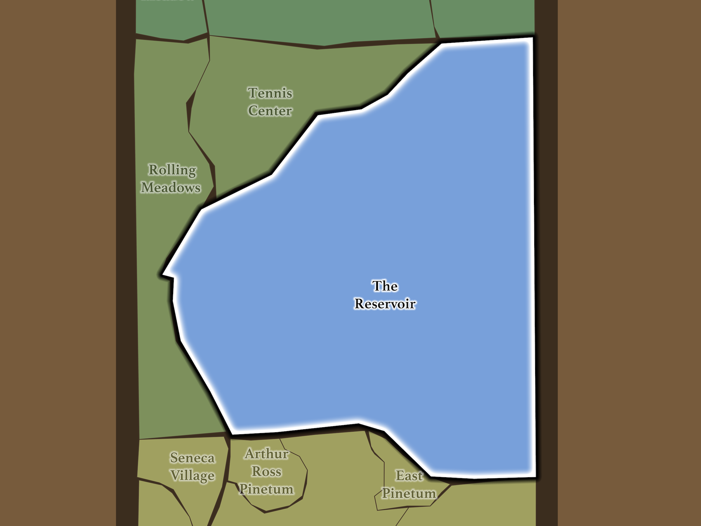
The Reservoir overwhelmingly defines Mid-Park North. Rolling Meadows lies across West Drive to the west; the Tennis Center occupies the landscape northwest of the Bridle Path; East Meadow begins beyond the 97th Street Transverse; Metropolitan Hill, Carnegie Hill and Spanish Harlem line Fifth Avenue to the east; and the Metropolitan Museum of Art, East Pinetum, Great Lawn and Arthur Ross Pinetum lie south beyond the 86th Street Transverse.
Unlike almost every other Central Park neighborhood, the central feature itself is inaccessible. Visitors instead experience the Reservoir from a succession of concentric landscapes: water and shoreline at the center, the 1.58-mile running track immediately outside it, the Bridle Path beyond that, and the park drives and surrounding landscapes farther out.
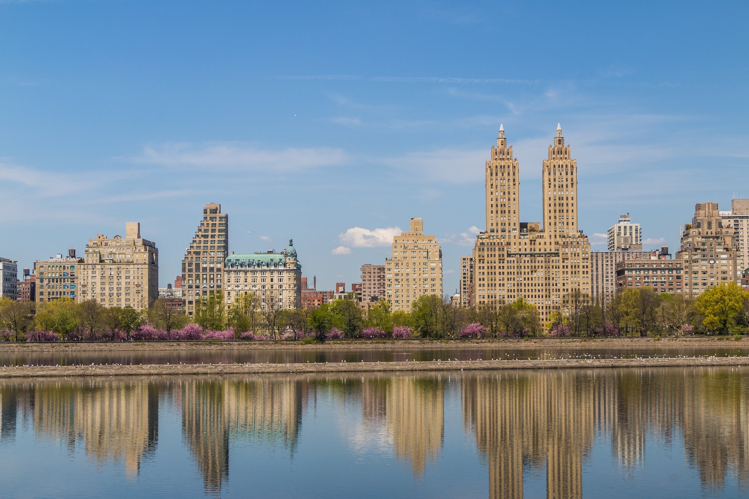
That arrangement makes the Reservoir feel both immense and surprisingly varied. The water is constant, but every circuit changes the city around it—Central Park West’s apartment towers, Fifth Avenue, the Midtown skyline, park woodland and open northern landscapes continually rotating into view.
Etymology
The Reservoir is named for the enormous water-storage structure that dominates Mid-Park North. At 106 acres, the Jacqueline Kennedy Onassis Reservoir is the largest single landscape feature in Central Park, spanning nearly the entire width of the park between 86th and 96th Streets. It was originally known as the Upper Reservoir, distinguishing it from the older Receiving Reservoir that once occupied the present Great Lawn. Central Park Conservancy
The City formally renamed it the Jacqueline Kennedy Onassis Reservoir in 1994, honoring both Onassis’s contributions to New York and her personal attachment to Central Park; she was herself a regular runner around the Reservoir.
History
1858–1873: Greensward Plan & Construction
The Reservoir is unusual because Olmsted and Vaux did not simply decide to place an enormous lake here. Construction of the Upper Reservoir began in April 1858—the same month they submitted the Greensward Plan.
New York’s rapidly growing population had already strained the original Croton system, and the City needed a much larger storage basin. Olmsted and Vaux therefore had to design Central Park around an immense piece of active municipal infrastructure that was being constructed simultaneously with the park itself.
That constraint became one of the organizing facts of Central Park. Together with the older Receiving Reservoir to the south, the new basin divided what the designers referred to as the Upper and Lower Parks. Rather than disguise its scale completely, they wrapped it in drives, bridle paths, pedestrian walks, plantings and ornamental bridges, converting essential engineering into part of the park experience.
1858–1899: Early History & Grand Openings
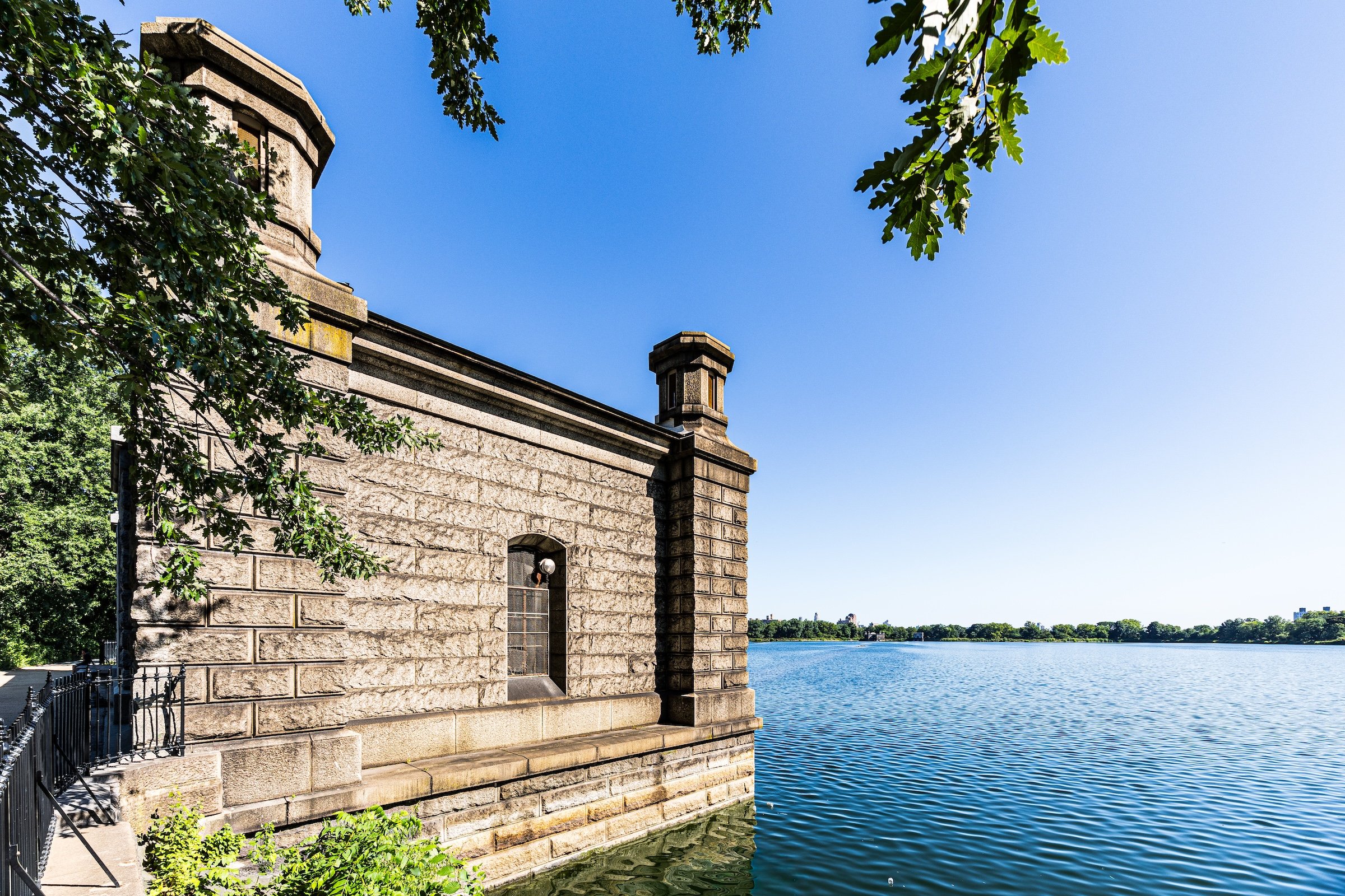
Constructed between 1858 and 1862 and placed into service during the early 1860s, the Reservoir could hold roughly one billion gallons of water. Its original system included north and south gatehouses regulating water entering from the Croton Aqueduct and leaving for distribution through Manhattan.
The surrounding circulation system was equally carefully considered. Three elegant cast-iron bridges—today numbered 24, 27 and 28—carried pedestrians over the Bridle Path toward the Reservoir promenade without forcing them to cross equestrian traffic. Bridge No. 28’s elaborate Gothic-inspired ironwork eventually earned it the familiar name Gothic Bridge.
The result was something remarkable: one of New York’s largest pieces of public infrastructure also became scenery.
20th Century: Transformation & Restoration
The Reservoir continued evolving as New York’s water system expanded. Construction of the New Croton Aqueduct in the 1890s brought another gatehouse to its northern end and dramatically increased the amount of water that could enter the basin. A fountain was installed in 1917 to mark completion of the City’s first water tunnel.
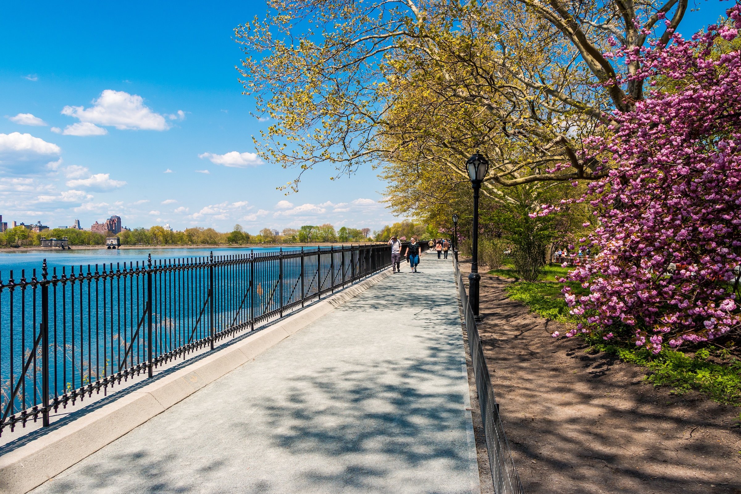
The surrounding landscape also became increasingly recreational. Cherry trees given to New York by Japan beginning in 1912 created one of the Reservoir’s great seasonal spectacles. Jogging became especially associated with the site during the later twentieth century, and in 1982 the perimeter path was surfaced with stone screenings to better accommodate runners.
By then, the waterworks function was nearing its end. The Reservoir was removed from the City’s drinking-water system in 1993 and renamed for Jacqueline Kennedy Onassis the following year. Its role had effectively reversed: what began as indispensable infrastructure had become one of Central Park’s principal recreational, scenic and ecological landscapes.
Explore
21st Century: Renovation & Modernization
Today, The Reservoir is perhaps the best example in Central Park of a place whose inaccessible center produces an extraordinary amount of activity around its edges.
The Stephanie and Fred Shuman Running Track circles the water for 1.58 miles and is one of New York’s best-known running routes. Its soft crushed-gravel surface is traveled counterclockwise, while the adjacent Bridle Path offers a wider, shaded alternative for walking and running. The Conservancy completed its most recent major renovation of the running track in 2024.
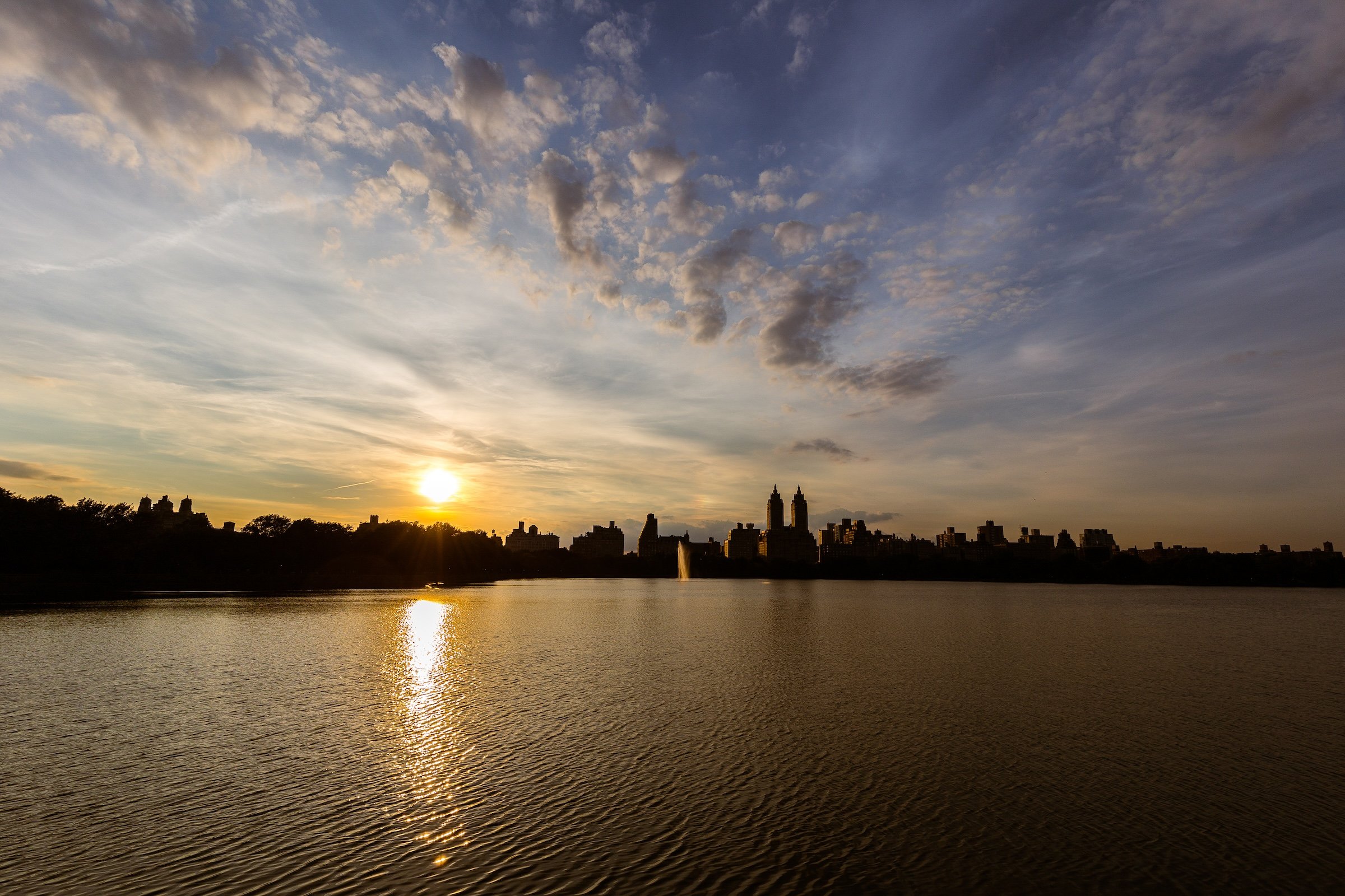
And the views continually justify another lap. The vast uninterrupted water surface creates unusually long sightlines for Central Park: the apartment towers of Central Park West rise almost as a continuous wall to the west, while Fifth Avenue, Midtown and the changing park canopy reveal themselves elsewhere around the circuit.
The Reservoir is also habitat. Although it has not supplied drinking water since 1993, its enormous body of water supports fish, turtles and numerous species of waterfowl, making the shoreline as useful for birdwatching as the track is for runners.
That combination explains the apparent paradox of the place. Almost all 106 acres are somewhere visitors cannot physically enter, yet the Reservoir remains one of the most versatile destinations in Central Park. You can run it, walk it, bird it, photograph it, watch blossoms along it, study nineteenth-century engineering around it—or simply stop and look across a scale of open water that Manhattan rarely permits.
Waypoints
-
Dedicated in 1894 by Danish Americans, the bronze depicts the celebrated Danish sculptor leaning against his own figure of Hope. After several relocations, it was placed in 1940 on its present knoll amid the ramps of the 97th Street Transverse.
-
At the southeastern corner of the Reservoir, this cast-iron bridge carries pedestrians over the Bridle Path to the running track. Its approach, known as Gilder Run, has become a familiar gathering and stretching point for runners.
-
Located near West 86th Street, Bridge No. 27 performs the same elegant bit of three-dimensional circulation: pedestrians pass above while the Bridle Path continues below.
-
The best known of the three cast-iron bridges surrounding the Reservoir, Bridge No. 28 crosses the Bridle Path near West 94th Street. Its ornate Gothic-inspired curves make it one of the most distinctive pieces of infrastructure in Mid-Park North.
-
The East 90th Street entrance is among Central Park’s original occupationally named gates and has become especially associated with runners entering the park from Fifth Avenue.
-
The bronze figure of New York City Marathon founder Fred Lebow stands near Engineers’ Gate, looking toward his stopwatch. Each Marathon Day, appropriately, the statue is moved to the race’s Central Park finish line.
-
Dedicated in 1928, this memorial to New York’s reform mayor extends beyond its bust and stone wall: the ornamental entrance pillars at Engineers’ Gate are part of the same composition. Mitchel’s connection to the City’s water system makes the Reservoir a particularly fitting location.
-
Located near East 96th Street, this large playground originated in 1936 and was comprehensively reconstructed in 2019 with wood climbing structures, water play, swings and improved integration with the surrounding park landscape.
-
One of the Reservoir’s historic water-control structures, the original northern gatehouse helped regulate Croton water entering the basin. A second northern gatehouse was added with expansion of the water system in the 1890s.
-
This compact waterworks structure preserves another visible piece of the Reservoir’s engineering history. Its ornamental iron details remain part of the Conservancy’s ongoing architectural conservation work.
-
One of the original water-control buildings constructed with the Reservoir, the fortress-like stone gatehouse at its southern edge survives as a substantial remnant of the Croton system. The DEP still maintains operational equipment within the Reservoir’s historic gatehouses.
-
The historic East 96th Street entrance was one of Central Park’s original named gates, part of the nineteenth-century system honoring the occupations and identities of New Yorkers. Contemporary nineteenth-century park guides explicitly identify the Fifth Avenue entrance at 96th Street as The Woodman’s Gate.
Photography
Visual Identity
Central Park has no single visual identity. It moves between open meadow and enclosed woodland, exposed bedrock and carefully planted garden, reflective water and hard-edged skyline. Its paths can narrow into shade beneath old trees, then open suddenly toward towers, lakes, monuments, or a broad field filled with people. The Park’s character is made from those transitions: the designed discovery of one landscape giving way to another.
Water and horizon recur throughout its geography. The Lake, Reservoir, ponds, fountains, and seasonal pools of light create places of reflection—sometimes literal, sometimes figurative—where the city appears fractured, softened, or enlarged. Beyond them, Manhattan’s towers remain present as a constant reminder that this cultivated landscape exists within, not apart from, one of the world’s densest cities.
Its visual language also changes dramatically with the seasons. Winter exposes branches, stone, and skyline; spring briefly turns the Park into blossom and color; summer fills its lawns and paths with activity; autumn intensifies the drama of canopy, water, and light. Central Park is designed to be revisited, and its identity is never fixed for long.