
HARLEM MEER
Location
Geographic Setting
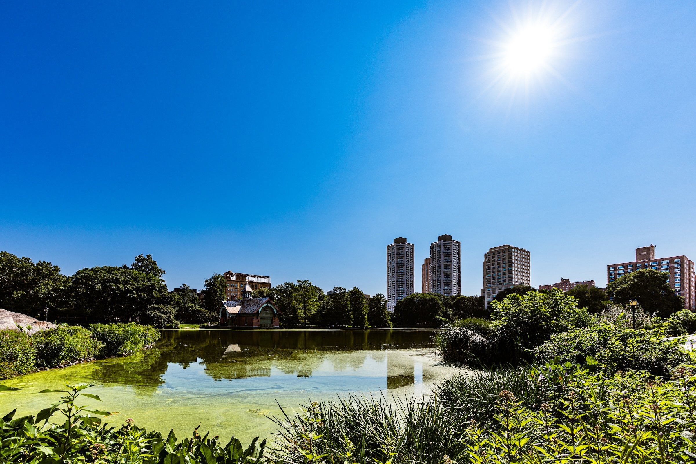
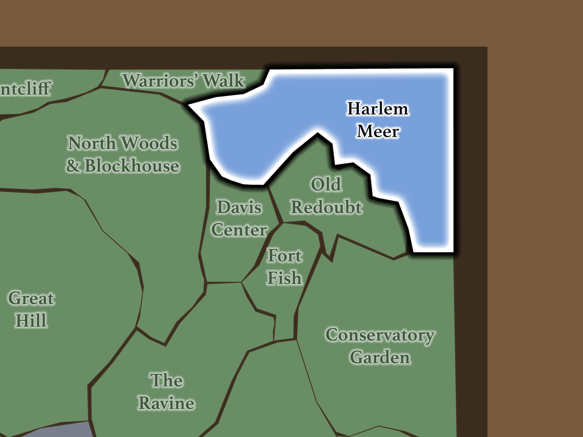
Harlem Meer occupies the northeastern corner of the North End. North Woods & Blockhouse lie across East Drive to the west; Warriors’ Walk runs beyond Malcolm X Boulevard along the northern edge; Harlem begins across Central Park North; Spanish Harlem lies across Fifth Avenue; Conservatory Garden sits to the southeast; Old Redoubt rises immediately south; and Davis Center occupies the southwestern shore.
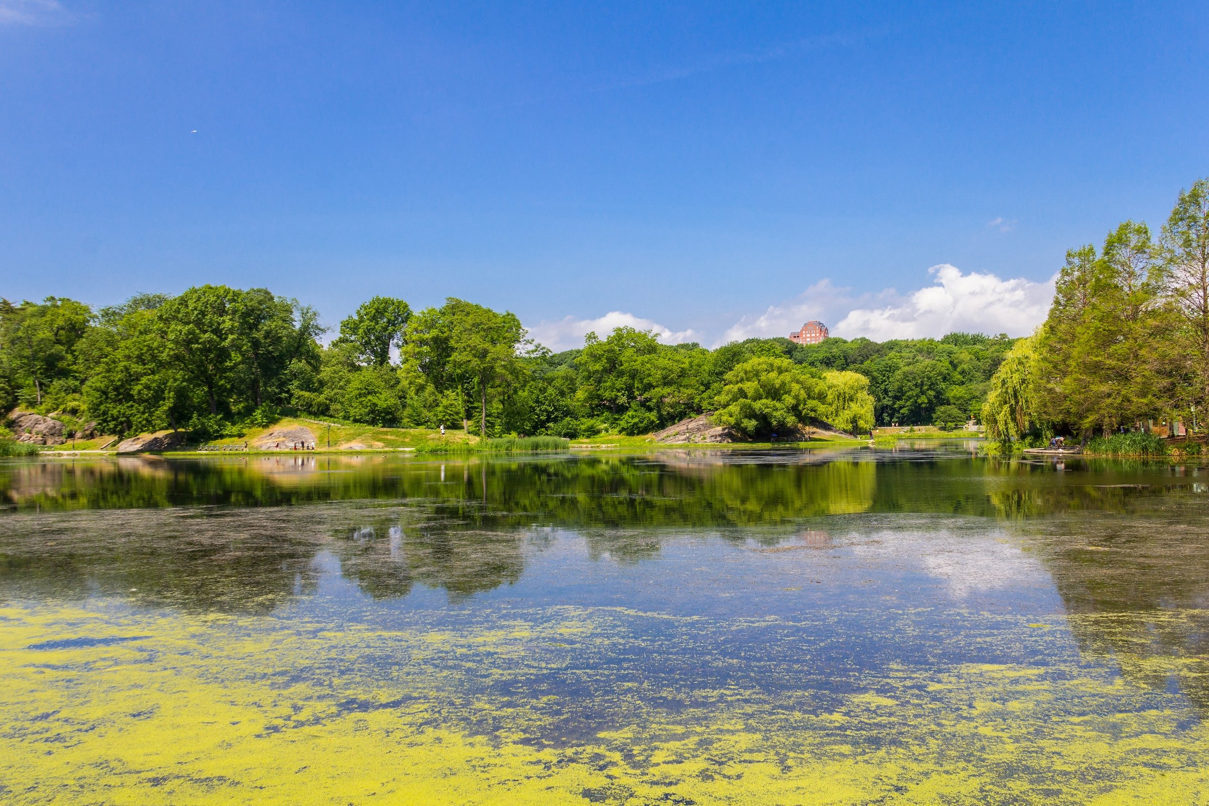
The roughly 11-acre water body curls around rocky bluffs, lawns, playgrounds and paths rather than forming a simple geometric basin. The Conservancy describes it as the final element in the North End’s connected watercourse: water moves from The Pool → The Loch → Harlem Meer.
Etymology
Harlem Meer takes its name from the historic community surrounding Central Park’s northern edge. Olmsted and Vaux deliberately chose the Dutch word meer, meaning “lake,” to recall the Dutch origins of Harlem, established as Nieuw Haarlem in the seventeenth century.
Today, that name feels even more geographically appropriate. The Meer sits directly between Harlem to the north and Spanish Harlem / El Barrio to the east, making the water one of Central Park’s clearest points of contact with the neighborhoods beyond its walls.
History
1858–1873: Greensward Plan & Construction
Before Central Park, this northeastern corner was marshland fed by Harlem Creek, a tidal watercourse connected toward the Harlem River. Olmsted and Vaux studied the existing low terrain and transformed it into the naturalistic lake now known as Harlem Meer.
They deliberately integrated the surrounding rock formations and steep bluffs into the composition. Paths along the shore and overlooks above it allowed visitors to experience the water from radically different elevations, while planting softened the engineered shoreline and made the Meer appear like a naturally occurring lake tucked into the North End.
It also formed the conclusion of one of Central Park’s most sophisticated water sequences. Water flowing through The Pool and Loch ultimately arrived here, tying the North Woods, Ravine and Meer into a single landscape system rather than three unrelated attractions.
1858–1899: Early History & Grand Openings
During Central Park’s nineteenth-century decades, the Meer was considerably more naturalistic than it would become during the following century. Grassy and planted banks met the water, while the surrounding fort landscapes provided elevated overlooks across the lake.
The northeastern shoreline also became closely associated with Central Park’s democratic entrance system. Along Central Park North were Farmers’ Gate and, farther east at Fifth Avenue, Pioneers’ Gate—the latter having originally been proposed as Explorers’ Gate. These entrances belonged to the commissioners’ larger effort to name park gateways for groups and occupations rather than individual elites.
The result was a landscape that already functioned as both picturesque destination and gateway between the park and Harlem.
20th Century: Transformation & Restoration
During the twentieth century, recreation increasingly hardened the Meer’s shoreline.
A boathouse appeared in the late 1920s, playgrounds followed during the 1930s, and a major redevelopment during the 1940s replaced much of the original planted shoreline with concrete retaining walls, pavement and fencing. By mid-century, the water remained a neighborhood resource, but much of Olmsted and Vaux’s naturalistic landscape had disappeared.
The Meer became one of the great restoration stories of the early Central Park Conservancy. Beginning in the late 1980s, workers removed 34,000 cubic yards of sediment and debris, rebuilt shoreline with Manhattan schist and wetland planting, restored lawns and created a wildlife island to help screen Lasker Rink and Pool. The restored Meer reopened in 1993.
That same year brought the Charles A. Dana Discovery Center, conceived not merely as a visitor facility but as a hub for environmental education, community events and renewed engagement between Central Park and its northern neighbors.
The restoration also created the Cissy Patterson Shoreline Walk, named for the journalist whose trust supplied the first major funding for the Meer project
Explore
21st Century: Renovation & Modernization
Harlem Meer is to the North End what The Pond is to the South End—a great body of water defining the park’s relationship with the city around it—but on a broader scale.
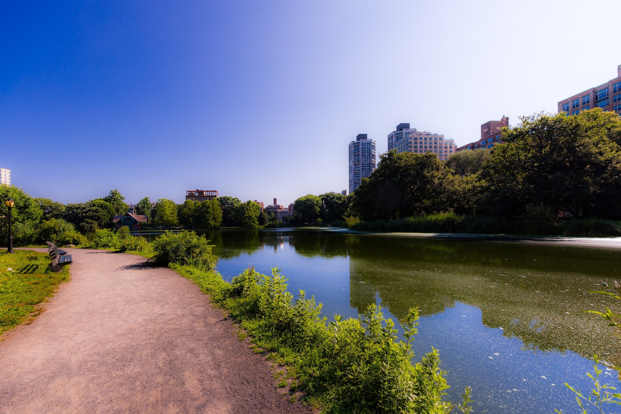
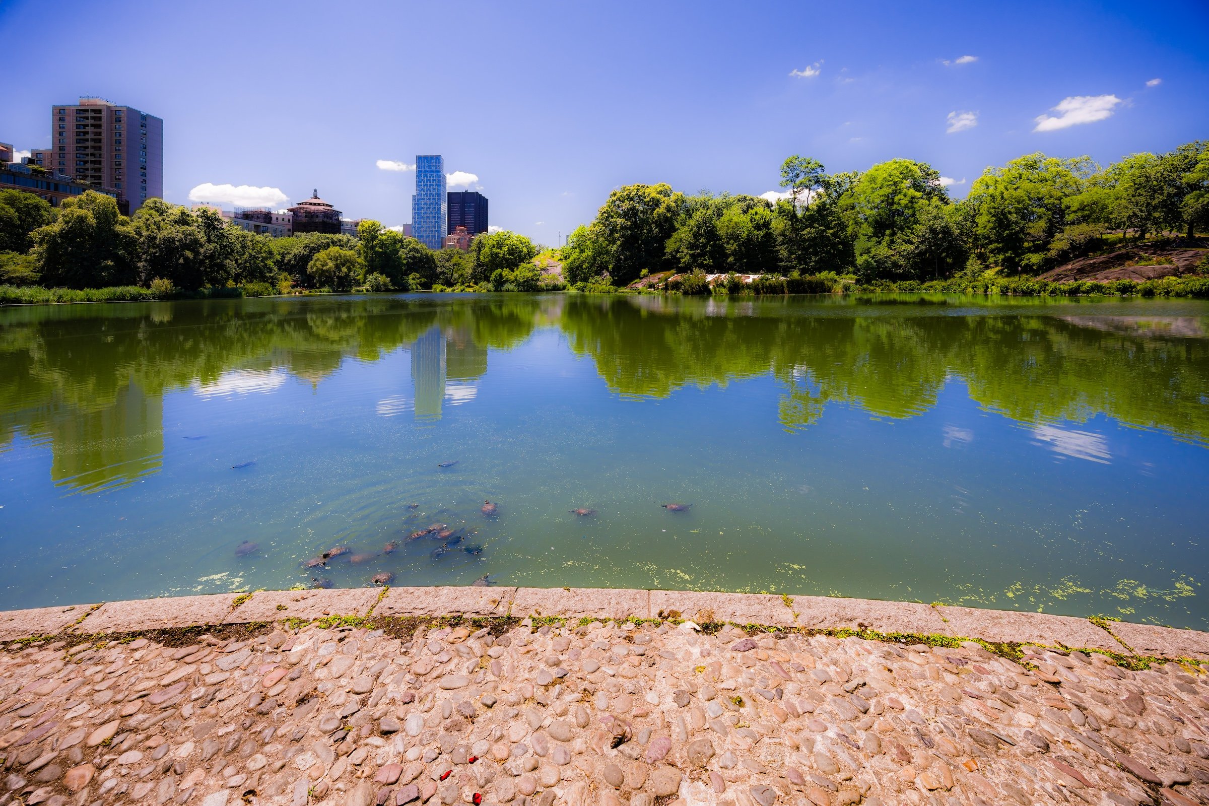
A walk along the shoreline continually changes perspective. From the north, the Fort Landscape rises behind the water. From the east, the long curve of the Meer opens toward the North Woods. Duck Island provides a focal point near the center, while turtles regularly swim or haul themselves onto rocks and logs to sun. Fish and waterfowl make the Meer one of the North End’s important wildlife habitats.
It is also one of Central Park’s most community-oriented landscapes. The Dana Center hosts exhibitions, educational programs and cultural events; playgrounds line the northern and eastern shore; Davis Center now brings swimming, skating and year-round recreation to the southwest; and the Harlem Meer Performance Festival has linked the landscape with music and dance for decades.
The north edge has also continued evolving as a civic threshold. In 2022, the new Gate of the Exonerated became the first additional named Central Park entrance since the nineteenth century, recognizing the Exonerated Five and, more broadly, people wrongfully convicted of crimes.
Even Farmers’ Gate has acquired new contemporary life: in 2026 the Conservancy began hosting a seasonal farm stand there, turning an old gate name into a remarkably literal twenty-first-century gathering place.
And the landscape is still changing. The Conservancy is currently designing a new Harlem Meer Shoreline Restoration & Boardwalk project, building on the 1990s restoration and the recent Davis Center reconstruction.
Waypoints
-
The smallest playground in Central Park sits along the Meer’s eastern shore and is designed particularly for toddlers and preschool-age children. Rebuilt in 2018, its shaded setting preserves views across the water while integrating play structures, sand and water features into the landscape.
-
Opened in 1993 as part of the Meer restoration, the Dana Center was Central Park’s first purpose-built visitor center in the Upper Park. It now serves as a hub for exhibitions, environmental education, community programs and seasonal events.
-
Created during the major Harlem Meer restoration completed in 1993, the shoreline walk honors journalist Cissy Patterson, whose trust provided the project’s earliest major financial support. It allows the restored naturalistic edge of the Meer to be experienced at water level.
-
Originally built in 1936, this popular lakeside playground was comprehensively rebuilt in 2013 with linked play areas, water features and landscaping designed to integrate recreation with views of the Meer. It is currently receiving additional repairs and upgrades.
-
Located at Central Park North and Malcolm X Boulevard, Farmers’ Gate belongs to the original 1862 entrance-naming system. In 2026, the name gained an unexpectedly literal new expression when a seasonal community farm stand began operating just inside the gate overlooking the Meer.
-
Dedicated in 2022 along Central Park North, this entrance honors the Exonerated Five and all people who have been wrongfully convicted. It is the first and only official addition to Central Park’s named entrances since the original nineteenth-century system.
-
At Fifth Avenue and 110th Street, Pioneers’ Gate marks the park’s northeastern corner. Originally proposed as Explorers’ Gate, the name evolved before the nineteenth-century gate system became fixed.
Photography
Visual Identity
Central Park has no single visual identity. It moves between open meadow and enclosed woodland, exposed bedrock and carefully planted garden, reflective water and hard-edged skyline. Its paths can narrow into shade beneath old trees, then open suddenly toward towers, lakes, monuments, or a broad field filled with people. The Park’s character is made from those transitions: the designed discovery of one landscape giving way to another.
Water and horizon recur throughout its geography. The Lake, Reservoir, ponds, fountains, and seasonal pools of light create places of reflection—sometimes literal, sometimes figurative—where the city appears fractured, softened, or enlarged. Beyond them, Manhattan’s towers remain present as a constant reminder that this cultivated landscape exists within, not apart from, one of the world’s densest cities.
Its visual language also changes dramatically with the seasons. Winter exposes branches, stone, and skyline; spring briefly turns the Park into blossom and color; summer fills its lawns and paths with activity; autumn intensifies the drama of canopy, water, and light. Central Park is designed to be revisited, and its identity is never fixed for long.