
THE LAKE
Location
Geographic Setting
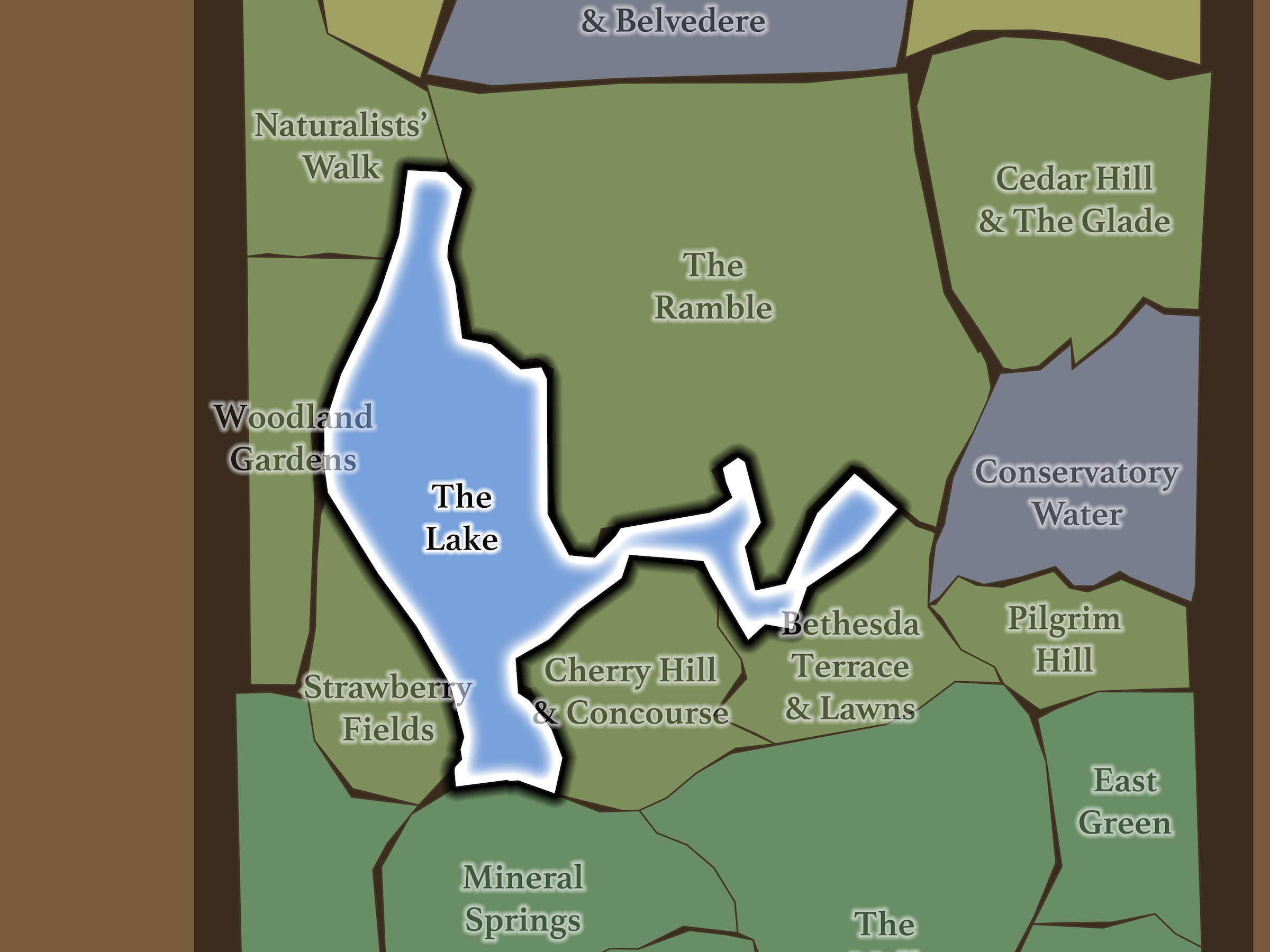
The Lake occupies approximately 20 acres at the heart of Mid-Park South. Strawberry Fields, Woodland Gardens and Naturalists’ Walk lie beyond West Drive along its western edge; The Ramble encloses much of the northern shoreline; the Central Park Boathouse anchors the eastern shore; Bethesda Terrace & Lawns meets the Lake at the southeast; and Cherry Hill & Concourse rises immediately to the south.
Within this taxonomy, The Lake extends beyond the water itself to include the shoreline paths, coves, overlooks, boat landings and Boathouse that make the water physically accessible and experientially complete.
That broader definition fits the way the landscape actually works. Visitors rarely experience The Lake as an isolated sheet of water. They experience it by walking beside it, crossing it, rowing across it, looking over it, descending toward it and repeatedly discovering it through openings in the surrounding landscape.
Etymology
The Lake is named with deceptive simplicity. Its wandering shoreline, coves, islands, rocky points and woodland edges make it feel as though Central Park grew around a preexisting body of water. In reality, The Lake is one of Olmsted and Vaux’s most complete acts of landscape invention.
The Central Park Conservancy describes the park’s naturalistic lakes and streams as entirely constructed landscapes, created through drainage, excavation, grading and planting. The Lake was designed to look discovered rather than built.
That illusion remains remarkably convincing.
History
1858–1873: Greensward Plan & Construction
The Lake was central to Olmsted and Vaux’s original conception of Central Park.
Their competition plan actually labeled it the “Skating Pond,” reflecting the importance they placed on winter recreation. But the designers intended it to do far more than provide ice. Its winding form, irregular shoreline and carefully composed relationship with the Ramble, Bethesda Terrace and surrounding hills were meant to create the impression of a large rural lake embedded naturally within the Manhattan landscape.
The illusion required immense engineering. Central Park’s naturalistic water bodies were created from low-lying and swampy terrain through excavation, drainage and reshaping. Rock outcrops were preserved or exposed, shoreline contours were manipulated, and surrounding vegetation was planted to make the completed landscape appear older than the park itself.
The Lake was therefore simultaneously engineering and scenery—a man-made water body designed specifically to conceal the fact that it had been made.
1858–1899: Early History & Grand Openings
The Lake became the first Central Park landscape opened to the public, in the winter of 1858.
On Christmas morning, an estimated 8,000 people arrived to skate, while later winter days reportedly drew crowds reaching roughly 30,000. For many New Yorkers, their first experience of the still-unfinished Central Park was therefore already centered upon The Lake.
Boating followed during the 1860s and quickly became another defining activity. Park designers created six picturesque boat landings around the shoreline, each individually designed as both dock and scenic lookout. A passenger boat traveled between the landings and Bethesda Terrace, while smaller boats and gondolas could be hired for more leisurely trips.
The Lake also became the setting for some of Central Park’s finest architecture. Bow Bridge, constructed during the early 1860s, connected Cherry Hill and Bethesda’s side of the park with the Ramble and became the only one of Central Park’s original ornamental cast-iron bridges to span a body of water rather than a circulation route.
20th Century: Transformation & Restoration
The Lake’s scenery proved enduring, but its infrastructure did not.
The original wooden boat landings deteriorated repeatedly and were rebuilt several times before gradually disappearing; by 1970 none remained. Several were reconstructed during that decade, but much of their original detailing had already been lost.
The nineteenth-century Boathouse also disappeared. Calvert Vaux’s ornate wooden structure, constructed in the 1870s, deteriorated and was replaced during the 1950s by the present building, which combined boat rentals with dining and visitor facilities.
Meanwhile, other historic features migrated into the Lake landscape. Jacob Wrey Mould’s Ladies Pavilion, originally built in 1871 as a shelter for carriage riders near the southwest entrance, was moved to Hernshead in 1913 when construction of the Maine Monument displaced it.
By the late twentieth century, erosion, failing infrastructure and accumulated sediment had degraded large portions of the shoreline. The Conservancy undertook a comprehensive multi-year restoration between 2006 and 2010, stabilizing shoreline, restoring ecological plantings, rebuilding drainage and recovering long-lost views.
In 2016, five historically documented boat landings were reconstructed in forms closely based on their nineteenth-century predecessors, returning another layer of the original Lake experience.
Explore
21st Century: Renovation & Modernization
The Lake may offer the fullest single demonstration of Central Park’s variety.
Follow its shoreline and the experience keeps changing. Around Cherry Hill, blossoms and open lawns frame the water. At Hernshead, exposed rock projects into the Lake beneath the Ladies Pavilion. Bow Bridge introduces one of the park’s great architectural gestures. The northern shoreline becomes increasingly wooded as the Ramble closes around the water. Oak Bridge opens views across Bank Rock Bay and the Midtown skyline. Along the east, rowboats gather around the Boathouse before the landscape resolves again into the grandeur of Bethesda Terrace.
The water ties all of it together.
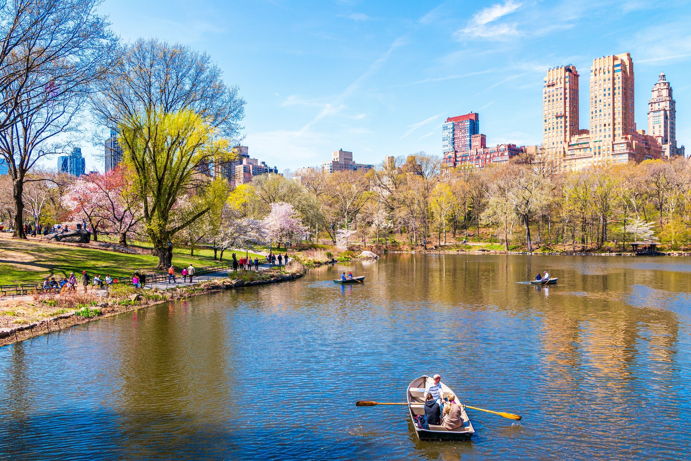
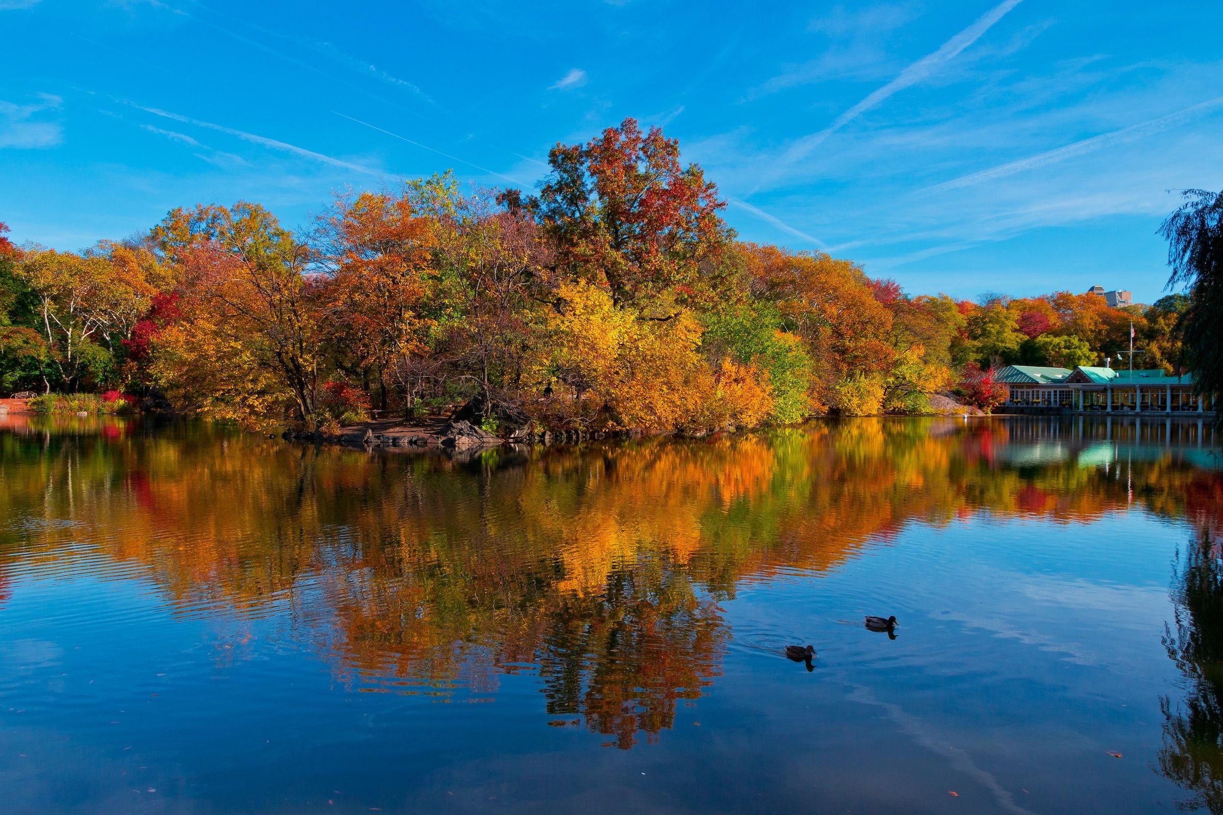
And because it reflects everything around it, The Lake changes more dramatically with season and weather than almost any other Central Park landscape. Spring blossoms appear doubled in the water. Summer boats move beneath heavy green canopy. Autumn color spreads across both shoreline and reflection. Winter strips the composition to branches, rock, architecture and cold light.
Even the city becomes part of the scenery. Central Park West’s towers rise behind the trees on the western shore, while Midtown occasionally appears through gaps in the Ramble and around the southern coves.
The Lake is therefore both destination and gateway. It contains famous places, but it also connects them. Bow Bridge leads into the Ramble. The Boathouse makes the water itself accessible. Bethesda Terrace terminates at its shore. Cherry Hill overlooks it. Strawberry Fields, Hernshead and Naturalists’ Walk all reveal different versions of it.
You can circle The Lake dozens of times and never quite take the same walk.
Waypoints
-
West Drive passes across this bridge at the northwestern side of The Lake. Small balcony-like seating areas built into its railing give the structure its name and provide elevated views across the water.
-
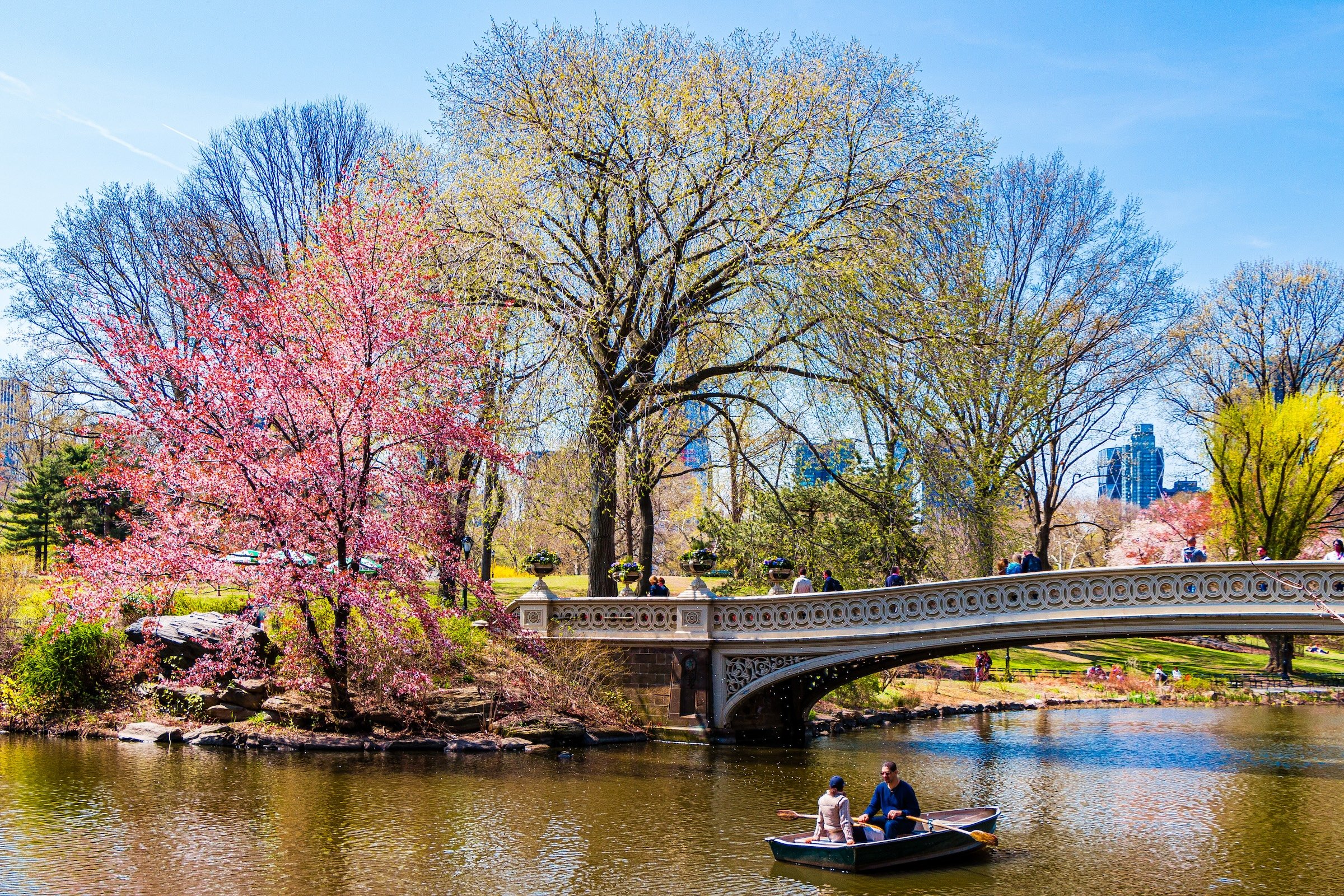
Built in the early 1860s, Calvert Vaux’s graceful cast-iron bridge connects the southern landscapes with the Ramble. Its low arc, reflected in the water beneath it, has made it one of Central Park’s most photographed and romantic landmarks.
-
Boating has been part of The Lake since the 1860s. The present Boathouse replaced Calvert Vaux’s nineteenth-century structure in the 1950s and remains the principal launching point for rowboats as well as one of Central Park’s best-known lakeside dining destinations.
-
This substantial rock outcrop projects into the western side of The Lake and was named by Olmsted and Vaux because its shape reminded them of a heron’s head. Its elevated stone and surrounding spring plantings provide broad views across the water and toward the skyline.
-
Five reconstructed landings—Western Shore, Hernshead, Wagner Cove, Bow Bridge and Bank Rock—recall the six scenic docks originally constructed beginning in 1860. They function as both shoreline shelters and deliberately composed places from which to look across The Lake.
-
Jacob Wrey Mould’s elegant cast-iron shelter was moved to Hernshead in 1913 from its original location near today’s Merchants’ Gate. Its delicate Victorian structure and lakeside setting make it one of The Lake’s most intimate overlooks.
-
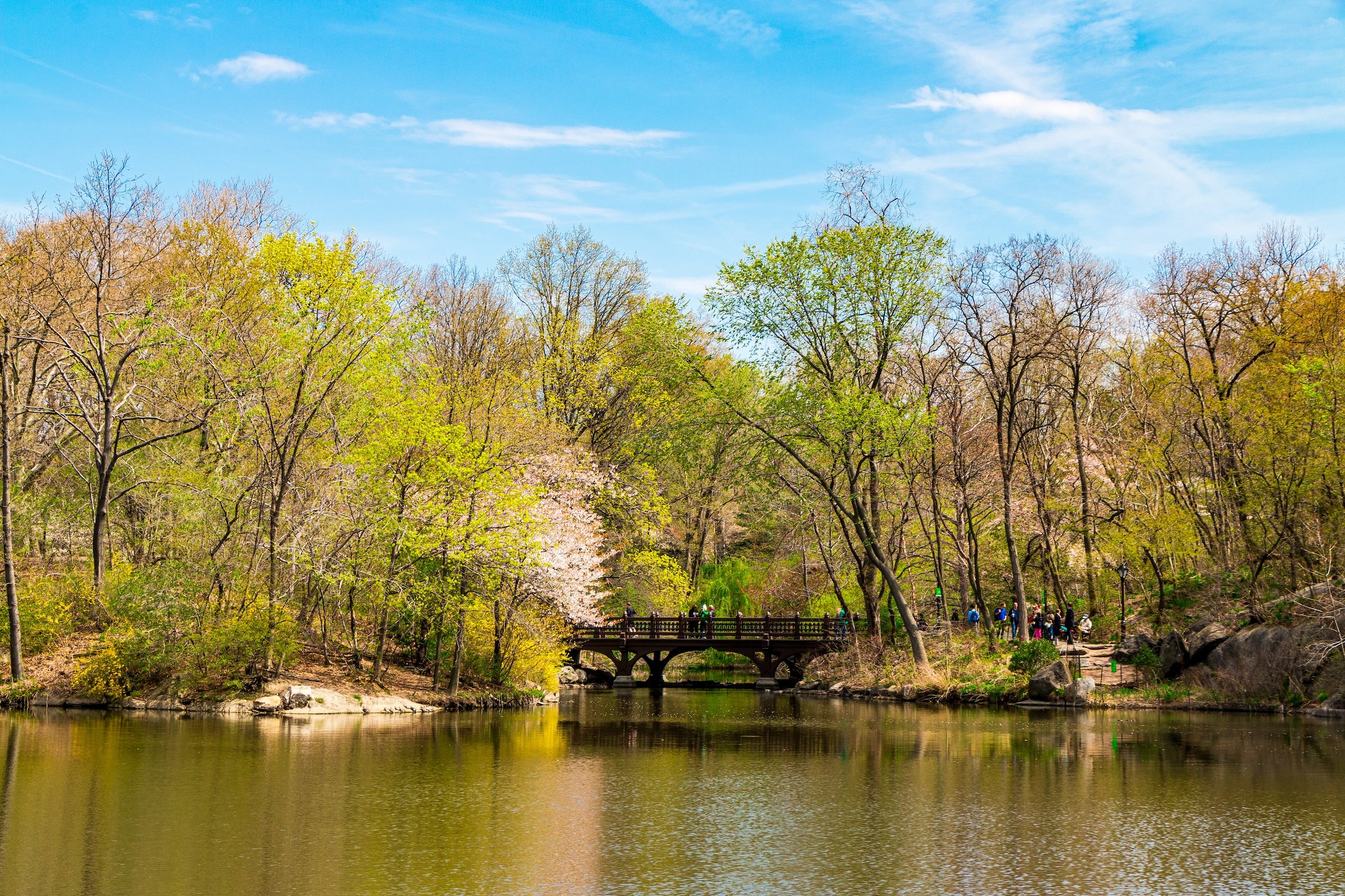
Spanning the entrance to Bank Rock Bay, Oak Bridge was originally conceived as one of the major gateways into the Ramble. The Conservancy reconstructed it in 2009 using modern structural materials while restoring the white-oak character of Vaux’s original design.
-
A small western-shore projection offers another intimate place to step out toward the water, reinforcing how frequently The Lake’s shoreline alternates between enclosed paths and sudden panoramic views.
-
Tucked into the southernmost portion of The Lake, this rustic boat landing creates one of the water’s most secluded settings. Its present structure is a reconstruction of the nineteenth-century landing that once served the passenger-boat circuit.
-
One of the reconstructed nineteenth-century boat landings, this shaded structure sits close to West Drive and provides particularly strong views toward Bow Bridge.
Photography
Visual Identity
Central Park has no single visual identity. It moves between open meadow and enclosed woodland, exposed bedrock and carefully planted garden, reflective water and hard-edged skyline. Its paths can narrow into shade beneath old trees, then open suddenly toward towers, lakes, monuments, or a broad field filled with people. The Park’s character is made from those transitions: the designed discovery of one landscape giving way to another.
Water and horizon recur throughout its geography. The Lake, Reservoir, ponds, fountains, and seasonal pools of light create places of reflection—sometimes literal, sometimes figurative—where the city appears fractured, softened, or enlarged. Beyond them, Manhattan’s towers remain present as a constant reminder that this cultivated landscape exists within, not apart from, one of the world’s densest cities.
Its visual language also changes dramatically with the seasons. Winter exposes branches, stone, and skyline; spring briefly turns the Park into blossom and color; summer fills its lawns and paths with activity; autumn intensifies the drama of canopy, water, and light. Central Park is designed to be revisited, and its identity is never fixed for long.