
THE RAVINE
Location
Geographic Setting
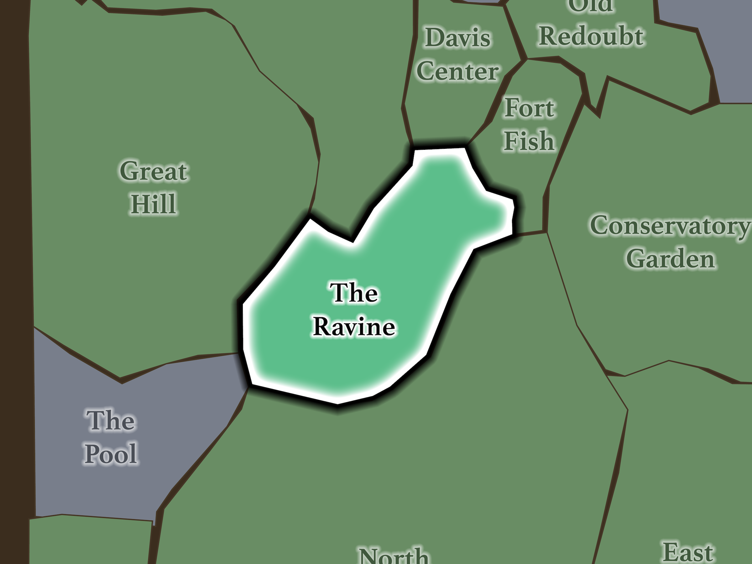
The Ravine cuts eastward through the center of the North End. Great Hill rises beyond West Drive; North Woods & Blockhouse occupies the higher woodland beyond the Loch Walking Path; Davis Center lies through Huddlestone Arch to the northeast; Fort Fish rises to the east; North Meadow begins below the 102nd Street Crossing; and The Pool lies beyond Glen Span Arch to the west.
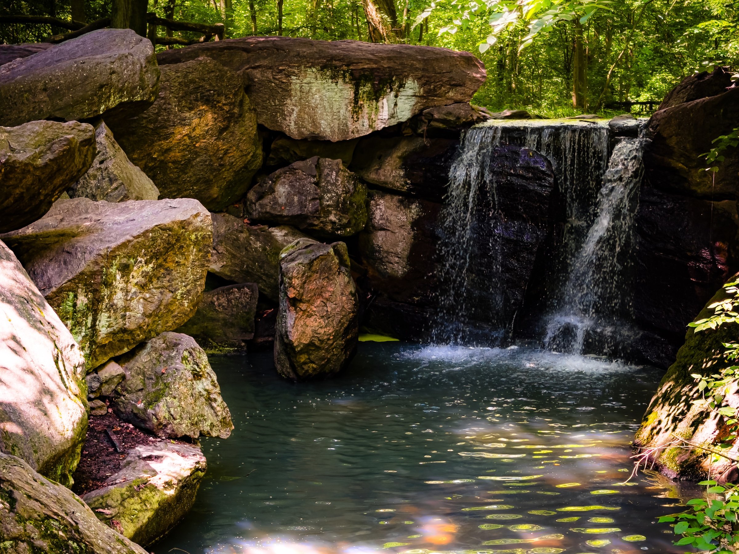
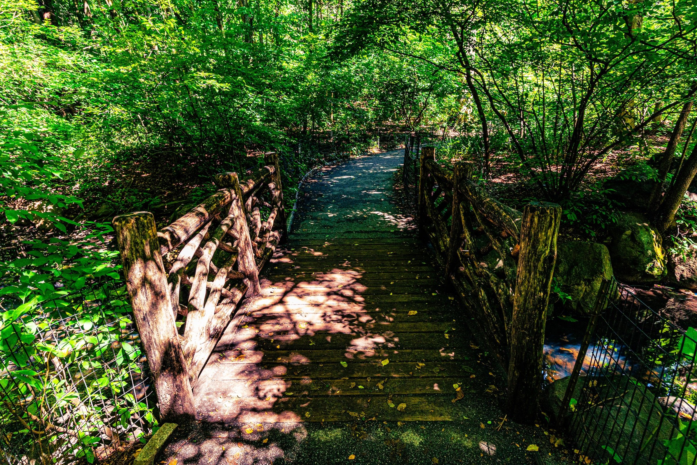
The terrain is deeply enclosed. Wooded slopes descend toward the Loch, while paths repeatedly change elevation above and beside the stream. Cascades, rustic bridges and exposed rock interrupt the watercourse before the valley finally opens toward Harlem Meer.
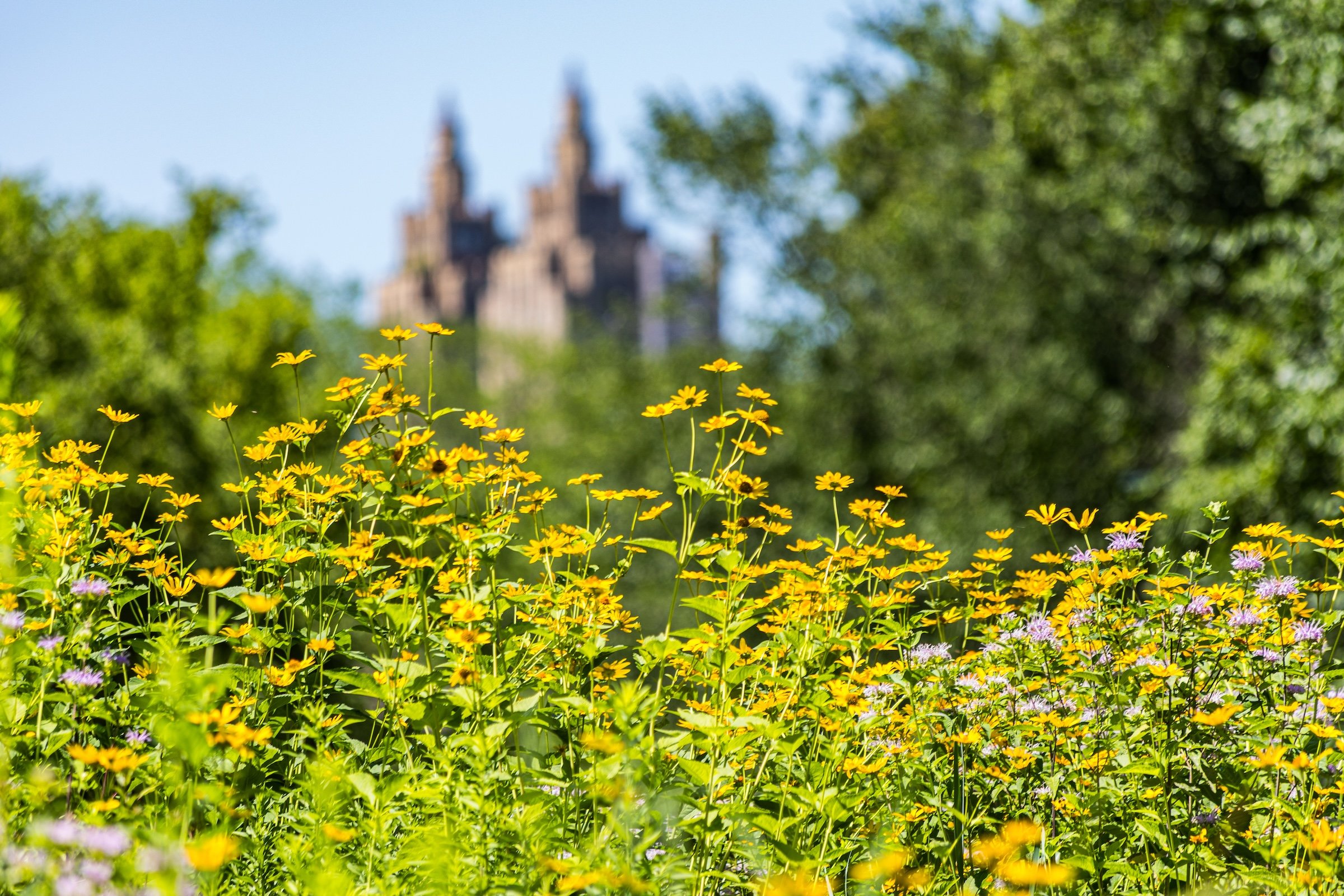
At the eastern end, the woodland loosens into the much more open Wildflower Meadow, providing one final shift in landscape before the Ravine reaches Huddlestone Arch and the Davis Center beyond. The Conservancy’s own North Woods guide identifies the meadow as a destination reached by rustic trails branching from the Loch.
Etymology
The Ravine takes its name from the steep, wooded stream valley running through the North Woods. The term describes more than the watercourse itself: the Ravine includes the sloping woodland on either side of The Loch, creating a complete landscape of stream, cascades, rock, trees and rising terrain. The Central Park Conservancy likewise identifies the Ravine as a distinct landscape within the larger North Woods.
That broader definition is important. The Loch is the thread running through the landscape; the Ravine is the valley that contains it.
History
1858–1873: Greensward Plan & Construction
The Ravine is one of the clearest examples of Olmsted and Vaux taking an existing piece of Manhattan geography and dramatically amplifying it.
A natural stream known as Montayne’s Rivulet already flowed through this valley before Central Park. Rather than erase it, the designers used its course as the foundation for their woodland landscape. Park builders widened and dammed the stream, deepened portions of the valley, created cascades and planted the surrounding slopes densely with trees and shrubs.
The goal was not simply to create a stream but to evoke the wooded ravines of the Catskills and Adirondacks—the kind of scenery many nineteenth-century New Yorkers could not afford to travel to see.
The resulting landscape is therefore both natural inheritance and deliberate construction: an existing valley transformed into a carefully composed wilderness.
1858–1899: Early History & Grand Openings
Olmsted and Vaux made the entrances to the Ravine into dramatic thresholds.
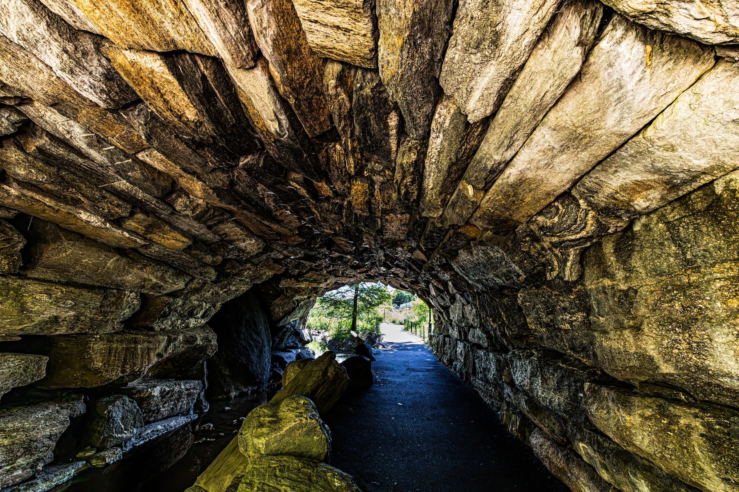
At the western end, Glen Span Arch carries West Drive above both the Loch and the pedestrian path. At the eastern end, Huddlestone Arch performs the same feat with even greater theatricality. Together, the arches frame the Ravine as though visitors are passing into and out of a hidden valley.
Huddlestone is particularly extraordinary. Its enormous uncut boulders were stacked without mortar or conventional supports, relying on gravity and pressure to hold the structure together. Olmsted and Vaux wanted it to appear less like engineered infrastructure than something almost geological—a natural portal through the woods.
Between those two thresholds, The Loch winds through pools and cascades under dense tree cover. The effect was exactly what the designers intended: a landscape that felt wild enough to make its construction nearly disappear.
20th Century: Transformation & Restoration
That illusion of wilderness became difficult to maintain during the twentieth century.
Like Central Park’s other woodlands, the Ravine suffered from erosion, invasive plants, deteriorating paths, failing infrastructure and degradation of the stream itself. Because woodland can appear “natural” even while ecological conditions are worsening, these problems accumulated over decades.
The Central Park Conservancy undertook a comprehensive restoration completed in 2017. The project removed accumulated sediment from the Loch, reconstructed paths and drainage, restored rustic bridges and stone steps, renewed plantings and repaired the surrounding slopes.
The most recent transformation came with completion of the Davis Center in 2025. Removal of the former Lasker complex restored the historic connection between the Loch and Harlem Meer and reopened the pedestrian route through Huddlestone Arch toward the water—reconnecting the Ravine with the landscape it was originally designed to flow into.
Explore
21st Century: Renovation & Modernization
Today, The Ravine is one of Central Park’s most immersive environments.
The Loch bubbles between rocks, drops over cascades and disappears beneath bridges while woodland rises sharply on either side. Paths alternate between the stream edge and higher slopes, creating constantly changing perspectives through the trees.
The landscape feels particularly alive because water and terrain are always interacting. You hear the Loch before you necessarily see it. A path may rise above the stream, descend toward a cascade, cross a rustic bridge and then disappear again into woodland.
And then, toward the eastern end, the environment changes.
The canopy opens onto Wildflower Meadow, a low, brushy clearing that has become especially important for birds and pollinators. The NYC Bird Alliance identifies it as a distinct North Woods habitat where wrens, kinglets, goldfinches, flycatchers and warblers can be found, particularly during migration.
That transition is precisely why the Ravine works better as a neighborhood than a narrower designation such as “The Loch.” The experience is not only water. It is stream + slope + woodland + meadow + passage.
Waypoints
-
The stream running through the Ravine forms its central spine, flowing through pools and cascades between Glen Span and Huddlestone Arches before continuing toward Harlem Meer. Its course follows the valley of the older Montayne’s Rivulet, reshaped by Olmsted and Vaux into one of Central Park’s most convincing naturalistic watercourses.
-
Reached by rustic trails above the eastern Loch, this open meadow breaks the dense woodland with grasses, wildflowers and low vegetation. The Conservancy includes it on its North Woods self-guided route, while birding organizations recognize it as an important habitat for migrating and breeding birds.
Photography
Visual Identity
Central Park has no single visual identity. It moves between open meadow and enclosed woodland, exposed bedrock and carefully planted garden, reflective water and hard-edged skyline. Its paths can narrow into shade beneath old trees, then open suddenly toward towers, lakes, monuments, or a broad field filled with people. The Park’s character is made from those transitions: the designed discovery of one landscape giving way to another.
Water and horizon recur throughout its geography. The Lake, Reservoir, ponds, fountains, and seasonal pools of light create places of reflection—sometimes literal, sometimes figurative—where the city appears fractured, softened, or enlarged. Beyond them, Manhattan’s towers remain present as a constant reminder that this cultivated landscape exists within, not apart from, one of the world’s densest cities.
Its visual language also changes dramatically with the seasons. Winter exposes branches, stone, and skyline; spring briefly turns the Park into blossom and color; summer fills its lawns and paths with activity; autumn intensifies the drama of canopy, water, and light. Central Park is designed to be revisited, and its identity is never fixed for long.